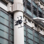
How to Use Drones for Home Exterior Inspections offers a comprehensive guide to leveraging unmanned aerial vehicles (UAVs) for efficient and thorough property assessments. This method provides a safer, faster, and often more cost-effective alternative to traditional inspection techniques, allowing for detailed visual examination of roofs, siding, gutters, and other hard-to-reach areas. This guide covers drone selection, safety protocols, operation techniques, data analysis, report generation, and legal considerations, empowering both professionals and homeowners to harness the power of drone technology for home exterior inspections.
From choosing the right drone model with features like obstacle avoidance and high-resolution cameras, to understanding necessary licenses and adhering to safety regulations, we’ll walk you through each step of the process. We’ll also explore effective flight patterns, data management strategies, and the creation of professional inspection reports that clearly communicate findings to clients. The aim is to provide a practical, step-by-step approach, equipping readers with the knowledge and confidence to safely and effectively utilize drones for home exterior inspections.
Drone Selection for Home Exterior Inspections
Choosing the right drone for home exterior inspections is crucial for obtaining high-quality images and ensuring safe operation. Several factors must be considered, including camera resolution, flight time, ease of use, and safety features. The ideal drone will balance these factors to provide efficient and reliable inspection results.
Drone Model Comparison
The selection of a drone depends heavily on individual needs and budget. Below is a comparison of three popular drone models suitable for home inspections. Note that prices and specifications can change, so always check the manufacturer’s website for the most up-to-date information.
| Model | Camera Specs | Flight Time | Price (USD, approximate) |
|---|---|---|---|
| DJI Mavic 3 | 48MP Hasselblad camera, 12MP wide-angle camera, 4K video recording | 46 minutes (approx.) | $2100 |
| DJI Mini 3 Pro | 48MP camera, 4K video recording | 34 minutes (approx.) | $900 |
| Autel EVO Nano+ | 50MP camera, 4K video recording | 28 minutes (approx.) | $700 |
Obstacle Avoidance Systems
Drones equipped with advanced obstacle avoidance systems are essential for safe operation around homes. These systems use sensors (such as ultrasonic, infrared, and vision sensors) to detect obstacles and automatically adjust the drone’s flight path, preventing collisions with trees, power lines, or the house itself. This is particularly important during close-range inspections where precision and safety are paramount. The presence of such features significantly reduces the risk of accidents and damage to both the drone and the property. Models like the DJI Mavic 3 and Autel EVO Nano+ offer robust obstacle avoidance capabilities.
Drone Licensing and Permits
Operating a drone for commercial purposes, including home inspections, often requires specific licenses and permits. In the United States, the Federal Aviation Administration (FAA) regulates drone operations. Operators typically need a Part 107 Remote Pilot Certificate, which involves passing a knowledge test. Additionally, depending on the location and nature of the inspection, local regulations and permits may also be required. It’s crucial to thoroughly research and comply with all applicable federal, state, and local laws before operating a drone for commercial use to avoid penalties. Failure to obtain the necessary licenses can result in significant fines. Contacting the FAA or your local aviation authority is recommended for the most accurate and up-to-date information on regulations.
Pre-Flight Checklist and Safety Procedures
Safe and effective drone operation for home exterior inspections requires meticulous preparation and adherence to strict safety protocols. A thorough pre-flight checklist and understanding of relevant safety procedures are crucial for minimizing risks and ensuring the integrity of the inspection. Neglecting these steps can lead to accidents, damage to the drone, property damage, or even injury.
Pre-Flight Checklist
Before each flight, a comprehensive checklist should be followed to ensure optimal drone performance and safety. This checklist covers essential aspects of the drone’s operational readiness and the environmental conditions. Skipping even one item can compromise the entire inspection.
- Drone Battery Check: Verify the drone battery is fully charged and in good condition. Check the battery voltage and ensure there are no signs of damage or swelling. A low battery can lead to unexpected power loss mid-flight.
- Camera Settings: Confirm that the camera resolution, video settings (frame rate, bitrate), and focus are appropriately set for the inspection. Ensure the memory card has sufficient storage space. Incorrect settings can result in unusable footage.
- Propeller Inspection: Visually inspect all propellers for any damage, cracks, or bends. Damaged propellers can cause instability or failure during flight.
- GPS Signal Acquisition: Ensure the drone has acquired a strong GPS signal before takeoff. A weak GPS signal can lead to inaccurate flight and potential crashes.
- Weather Conditions: Check the weather forecast for wind speed, precipitation, and visibility. Avoid flying in high winds (generally above 15 mph), rain, snow, or fog. Adverse weather conditions can significantly impact drone stability and control.
- No-Fly Zone Check: Utilize a flight planning app or online resources (like the FAA’s B4UFLY app in the USA) to identify and avoid restricted airspace, such as airports, heliports, and other no-fly zones. Flying in restricted airspace can lead to legal consequences and fines.
- Drone Software Update: Verify that the drone’s firmware is up-to-date. Software updates often include bug fixes and performance improvements.
- Visual Inspection: Conduct a thorough visual inspection of the drone for any physical damage or loose parts before each flight. Any damage should be addressed before attempting flight.
Safety Protocols
Implementing robust safety protocols is paramount to ensure the safety of the drone, the operator, and the property being inspected. These protocols should be followed consistently for every flight.
Maintain a safe distance from obstacles, including power lines, trees, and buildings. Always keep the drone within visual line of sight (VLOS), especially during inspections near structures. This ensures that the operator can react to unexpected situations. Avoid flying over people or crowds. In case of an emergency, a pre-planned landing zone should be identified and accessible.
No-Fly Zone Identification and Avoidance
Identifying and avoiding no-fly zones is a critical aspect of safe drone operation. Failing to do so can result in legal penalties and potential safety hazards.
Several resources are available to assist in identifying no-fly zones. The Federal Aviation Administration (FAA) in the United States provides a mobile application called B4UFLY that allows users to check for airspace restrictions in real-time. Similar applications and websites are available in other countries. Always check local regulations and restrictions before flying. Remember to plan your flight path carefully, considering all identified restrictions and potential hazards.
Drone Operation Techniques for Home Inspections
Effective drone operation is crucial for obtaining high-quality data during a home exterior inspection. Proper flight patterns, maneuvering techniques, and camera adjustments all contribute to a thorough and accurate assessment. This section details best practices for operating your drone to maximize the effectiveness of your inspection.
Optimal Flight Patterns and Altitudes
Maintaining consistent flight patterns and altitudes ensures comprehensive coverage and prevents image inconsistencies. A systematic approach, such as a grid pattern or a series of overlapping passes, is recommended. For optimal image resolution and detail, maintain a consistent altitude – generally between 50 and 100 feet, depending on the size of the house and the drone’s camera capabilities. Lower altitudes allow for more detailed images, but require more careful navigation and adherence to safety regulations. Higher altitudes provide a broader perspective but may result in less detailed images. Consider using the drone’s automated flight modes, such as “Waypoint Missions,” to ensure consistent altitude and coverage.
Maneuvering Around Obstacles
Navigating around obstacles like trees, power lines, and other structures requires careful planning and skillful piloting. Before initiating the flight, carefully survey the area to identify potential obstacles and plan a safe flight path. Use the drone’s obstacle avoidance features if available. If the obstacles cannot be avoided entirely, consider adjusting your flight path or altitude to ensure a safe distance is maintained. Slow and deliberate movements are essential, especially in confined spaces or near obstacles. Remember to always prioritize safety and avoid putting the drone at risk. For example, a flight path might involve circling a large tree, rather than flying directly over it.
Camera Angles and Zoom Levels
Utilizing different camera angles and zoom levels is essential for a thorough inspection. Start with a general overview of the house using a wide-angle shot from a higher altitude to establish context. Then, use progressively closer shots and different angles to inspect specific areas of concern. For example, high-angle shots are ideal for inspecting the roof for damage, while lower angles can be used to examine siding, windows, and gutters. The drone’s zoom capabilities allow for detailed inspection of hard-to-reach areas without needing to risk getting too close to the structure. Proper use of zoom can reveal small cracks, missing shingles, or other details that might be missed from a distance. Documenting each area with multiple shots from varying angles provides a comprehensive visual record.
Data Acquisition and Post-Processing
Efficient data acquisition and subsequent post-processing are crucial for generating a comprehensive and useful home exterior inspection report using drone imagery. High-quality data capture ensures the report’s accuracy, while streamlined post-processing minimizes time and effort, ultimately leading to a more efficient and professional service.
Capturing high-resolution images and videos requires careful planning and execution. Optimal image and video acquisition directly impacts the quality of the final inspection report, enabling the identification of even minor defects.
High-Resolution Image and Video Capture
Achieving high-resolution imagery necessitates understanding several key factors. First, ensure your drone’s camera settings are optimized for the lighting conditions. In bright sunlight, reducing exposure can prevent overexposure and maintain detail. Conversely, in low-light situations, increasing ISO sensitivity might be necessary, though this can introduce noise. Secondly, maintain a consistent altitude and overlap between consecutive images. A general guideline suggests a 70-80% overlap for effective photogrammetry (creating 3D models from images). This overlap is critical for stitching images together seamlessly in post-processing software. Thirdly, fly smoothly and avoid sudden movements to prevent blurry images. Using a gimbal helps to stabilize the camera and mitigate the effects of wind or other disturbances. Finally, consider capturing both images and videos. Videos offer a dynamic perspective, showcasing movement and context that still images may miss. For example, a video could effectively demonstrate the extent of roof damage or the movement of loose shingles.
Organizing and Storing Drone Data
Efficient data management is paramount. Immediately after each flight, download the data to a secure, external hard drive or cloud storage service. This prevents data loss and simplifies the post-processing workflow. Create a clear and consistent file-naming convention that includes the date, location, and flight number. For instance, a suitable format could be “20241027_1234_Flight1.dng” (using a RAW image format like DNG is recommended for maximum quality). Organize files into folders by project or client, ensuring easy retrieval of specific data sets. Regularly back up your data to a second location to protect against hardware failure or accidental deletion. Consider using cloud storage services with version control, enabling easy access and recovery of previous versions of your data.
Post-Processing Workflow for Inspection Reports
A well-defined post-processing workflow streamlines the creation of comprehensive inspection reports. Begin by importing the acquired images and videos into professional photogrammetry software, such as Pix4D or Agisoft Metashape. These programs stitch the images together to create an orthomosaic (a georeferenced image with minimal distortion) and a 3D model of the inspected area. Following the generation of the orthomosaic and 3D model, carefully examine these outputs for any defects or issues. Mark and annotate areas of concern directly on the orthomosaic using software tools. This process could include highlighting damaged shingles, cracks in the siding, or other problems. Finally, export the annotated orthomosaic, 3D model, and any relevant video clips into a professional-looking report, potentially using dedicated report-generation software. This final report should be easily understandable by clients, clearly outlining all identified issues and supporting them with visual evidence.
Creating a Comprehensive Inspection Report
A well-structured inspection report is crucial for conveying the findings of your drone survey effectively to your client. It should be clear, concise, and visually appealing, presenting the data in a way that is easily understood, even by those without technical expertise in drone technology or construction. This section will outline the key components of a comprehensive report and illustrate how to effectively integrate visual data to enhance understanding.
Sample Inspection Report Template
A standardized report template ensures consistency and clarity. The following example illustrates a suitable structure:
Property Address: [Insert Property Address Here]
Date of Inspection: [Insert Date Here]
Inspector: [Insert Inspector Name and Credentials Here]
1. Overall Condition: A summary statement describing the overall condition of the home’s exterior. For example: “The exterior of the property is generally in good condition, with minor repairs needed to the roof and some localized paint damage.”
2. Specific Damage Points: This section details specific areas of concern, using a numbered or bulleted list. Each point should include a detailed description, location (e.g., “south-facing gable end”), and visual reference (image or video ID). For example:
- Item 1: Missing shingles on the south-facing gable end (Image ID: 1A, 1B). Estimated area: 2 square feet.
- Item 2: Cracking in the stucco on the west elevation (Image ID: 2A). Extent of cracking approximately 12 inches in length.
- Item 3: Evidence of water damage around a second-story window (Video ID: 3A, timestamp 0:15-0:20). Further investigation recommended.
3. Recommended Actions: This section outlines suggested repairs or preventative measures. For example:
- Repair or replace missing shingles on the south-facing gable end to prevent further water damage.
- Inspect the stucco cracking for structural issues. Consider patching or full replacement depending on severity.
- Conduct a thorough inspection of the second-story window and surrounding area to determine the extent of water damage and necessary repairs.
Using Images and Videos to Illustrate Problems
High-resolution images and videos are essential for demonstrating the identified problems clearly. Images should be sharp, well-lit, and clearly show the damage. Videos can provide a more comprehensive overview, especially for larger areas or complex damage. Each image or video should be clearly labeled with a unique identifier (e.g., Image ID: 1A) and referenced in the report’s text. For example, an image labeled “Image ID: 1A” showing close-up damage to shingles should be accompanied by a description specifying the location and extent of the damage. A video showing a panoramic view of the roof might highlight a specific area of concern, with timestamps in the report to direct the viewer to the relevant section of the video.
Delivering the Inspection Report to the Client
The report can be delivered digitally in several formats, including PDF, which is universally compatible. A presentation format, perhaps using a slideshow software like PowerPoint, can be effective for clients who prefer a more visual presentation. Consider adding a summary page at the beginning of the report, outlining the key findings and recommendations. This allows the client to quickly grasp the overall condition of the property. Email delivery is convenient, and for larger projects, a secure cloud-based storage solution might be appropriate.
Legal and Ethical Considerations
Operating a drone for home inspections necessitates a thorough understanding of the legal and ethical frameworks governing its use. Failure to comply can result in significant legal repercussions and damage professional reputation. This section outlines key legal and ethical considerations to ensure safe and responsible drone operations.
Privacy Concerns and Property Rights
Drone operations must respect individual privacy rights and property boundaries. Unauthorized aerial surveillance of private property constitutes a violation of privacy and can lead to legal action, including lawsuits for invasion of privacy or trespass. Obtaining informed consent from property owners before conducting any drone flights is crucial. This consent should be documented in writing and should clearly outline the scope of the inspection, the areas to be covered, and the intended use of the collected data. Furthermore, operators should be mindful of local and national laws regarding airspace restrictions and flight limitations near sensitive areas like airports or military installations. Ignoring these regulations can lead to hefty fines and potential criminal charges. For instance, flying a drone within a restricted airspace without proper authorization could result in penalties from the relevant aviation authorities.
Client Confidentiality and Professional Integrity
Maintaining client confidentiality is paramount. All data collected during a drone inspection, including images and videos, should be treated as confidential and protected from unauthorized access or disclosure. This includes adhering to data protection regulations, such as GDPR or CCPA, depending on the jurisdiction. Professional integrity demands that inspectors maintain accurate records, provide objective assessments, and avoid conflicts of interest. For example, an inspector should not recommend services from a company in which they have a financial stake, even if it’s the best option for the client. Transparency with clients about the limitations of drone inspections is also essential; avoiding overselling the capabilities of the technology and managing client expectations effectively helps maintain ethical conduct.
Potential Risks and Liabilities
Drone inspections, while offering numerous benefits, involve inherent risks and liabilities. Accidents, such as drone crashes or data breaches, can lead to property damage, personal injury, or loss of confidential information. Maintaining comprehensive insurance coverage is crucial to mitigate potential financial losses. Regular maintenance and pre-flight checks are also essential to minimize the risk of mechanical failures. Moreover, operators should be prepared for unforeseen circumstances, such as unexpected weather conditions, and have contingency plans in place. For instance, having a backup plan for data storage in case of a drone malfunction can prevent the loss of valuable inspection data. Proper training and certification can significantly reduce risks and demonstrate professional competence, thus mitigating liability. Following all relevant safety guidelines and regulations is crucial in minimizing potential risks and liabilities associated with drone operations.
Outcome Summary
Mastering the use of drones for home exterior inspections opens up a world of possibilities for efficient and detailed property assessments. By carefully selecting appropriate equipment, adhering to safety protocols, and employing effective data analysis techniques, you can significantly enhance the accuracy and efficiency of your inspections. Remember, understanding the legal and ethical implications, along with consistent adherence to best practices, will ensure safe and responsible operation, ultimately leading to superior results and client satisfaction. This guide has provided a solid foundation; continuous learning and practical experience will further refine your skills in this rapidly evolving field.


